


Great Britain Map app for iPhone and iPad
Developer: Caversham Telecom Ltd
First release : 31 Mar 2015
App size: 0 Bytes
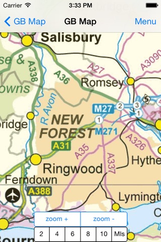
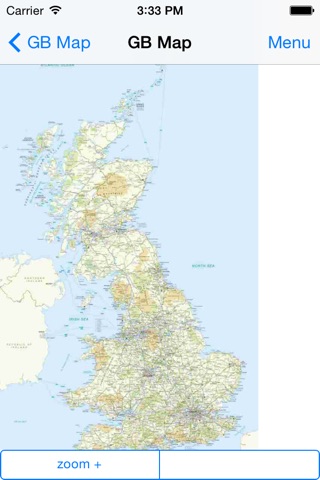
A stand alone offline (off-line) map atlas and gazetteer of Great Britain (GB) including the England, Wales, Scotland, Orkney, Shetland, Western Isles, Isles of Scilly and Isle of Man but excluding Northern Ireland and the Channel Islands. It shows A roads, B roads and motorways with junction numbers.
Once installed it works anywhere as it does not require any Internet connection nor any GPS. It reacts quickly to simple gestures for zoom and pan..
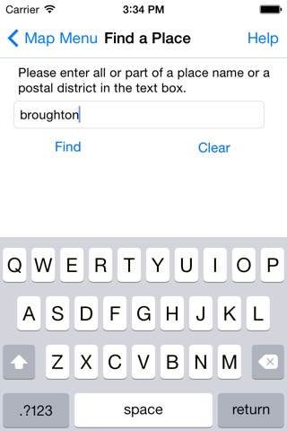
It uses Ordnance Survey maps and data and includes an easy-to-search gazetteer listing over 22,000 place names and nearly 3,000 postal districts in Great Britain. A postal district is the first half of a postcode, for example, B1, TD1 or NW10.
Easy, touch-screen, map selection. Panning across maps is supported by simple finger drag. The top zoom level is a Great Britain map and there are four zoom levels down to B road level but not street map level. At maximum zoom in, the scale is approximately 3 miles to 1 inch of screen on iPhone and 1 mile to 1 inch of screen on iPad. Please refer to the screen shots to see the level of detail provided.
Contains Ordnance Survey data © Crown copyright and database right 2015.
Contains Royal Mail data © Royal Mail copyright and database right 2015.
Contains National Statistics data © Crown copyright and database right 2015.
It’s not endorsed by Ordnance Survey nor any other UK government agency.